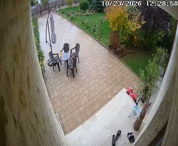
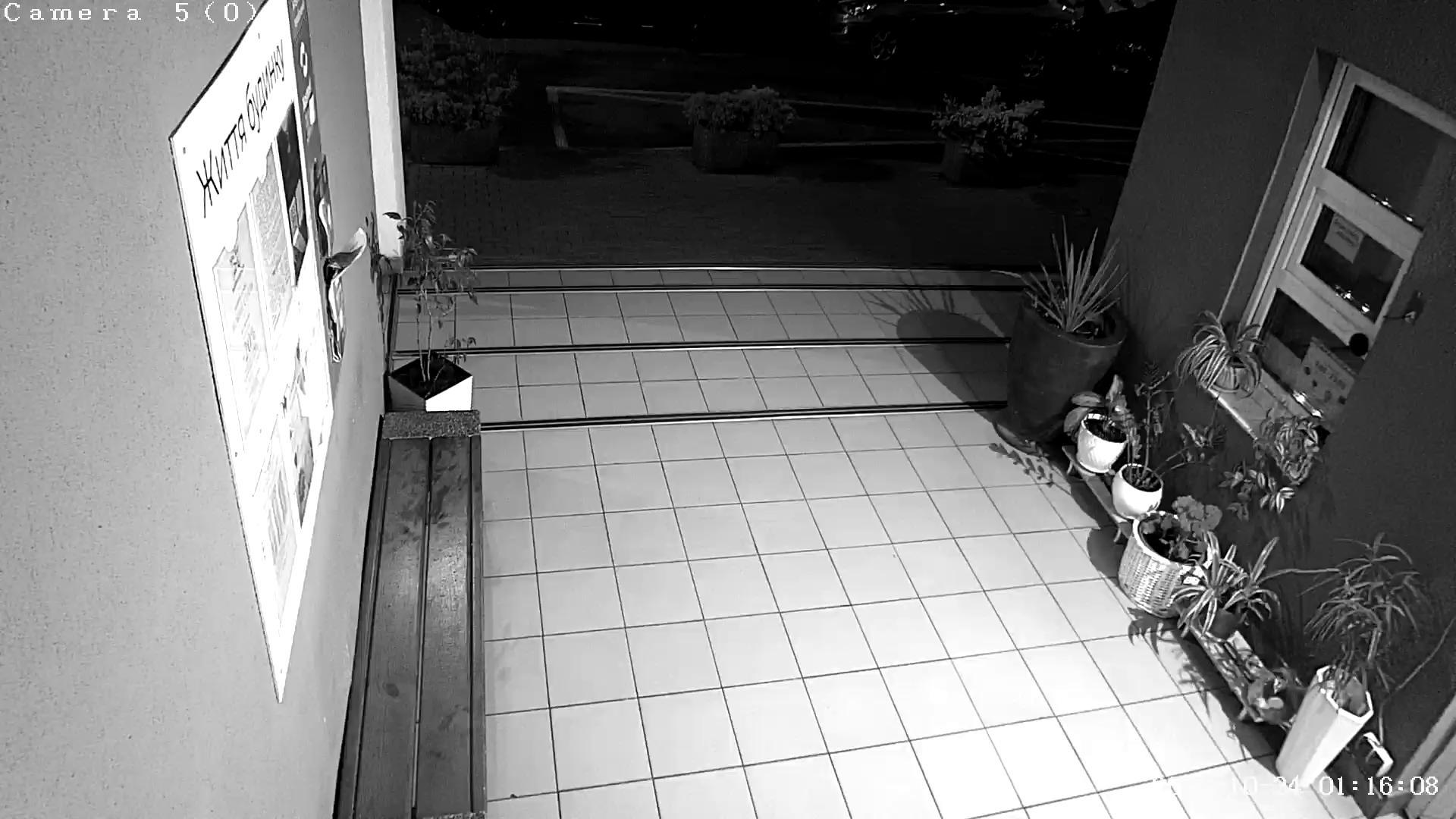
+++ BREAKING NEWS +++ 26.05.2026 15:08:54 A large billboard dominates the scene, glowing with a soft blue light. The billboard, attached to a gray pole, prominently displays the message "NOB.S. Bill Shock. Bye Bye." in bold pink and black letters against a blue background. The words "Medicom" are also visible on the billboard, possibly indicating the company responsible for creating or providing the billboard. The billboard appears to be illuminated, possibly by fluorescent lights. In the background, a highway stretches out, with cars visible in the distance. There's also a hint of a parking lot or a roadway near the billboard. The sky above is a canvas of clouds, casting a soft light over the scene.         26.05.2026 06:53:58 A two-lane highway stretches through a verdant landscape, flanked by expanses of lush green grass on either side. The road has a white dividing line and appears to lead into a field or open land. On the left side of the road, a sign indicates "Tie 86 Oulainen, Piipsjarvi". On the right side, a sign reads "100", indicating the distance to the town. The scene is bathed in soft light, suggesting a bright, sunny day. There is no visible vehicle on the road in the image.         25.05.2026 11:06:40 An aerial view of a city reveals a bustling urban landscape, with a variety of buildings in shades of white, gray, brown, and red. The buildings are interspersed with green spaces and trees, creating a natural contrast to the built environment. The city is situated on a hillside with a mix of greenery and buildings. A large square or plaza lies at the heart of the city, lined with trees. and featuring several domed-roof structures that stand out against the urban backdrop. The square is surrounded by a mix of residential and commercial buildings, and features roads and parking areas. A fountain or similar water feature is visible near the center of the square. Several banners or canopies are also seen throughout the square, possibly indicating an outdoor event. The image is marked with the watermark "www.next.rp", indicating it's likely taken from an aerial view or a video feed.         24.05.2026 11:06:02 A tall, narrow, stone church with a dome on top stands on a hilltop, accessible via a gravel path. The church's stone facade is bathed in sunlight, and a few people can be seen near the entrance. The surrounding landscape is primarily dry, with sparse, low-lying vegetation. The sky is a clear blue with a few white clouds. The image includes a timestamp of the scene, indicating it was captured on May 24, 2026, at 11:04:03. A website address, "www.schneeberg," is visible in the top left corner of the image.         25.05.2026 07:23:44 A lush green mountain landscape unfolds under a clear blue sky. A ski resort is nestled at the base of the mountain, featuring a variety of buildings, including some with brown roofs and white walls, interspersed with vibrant green trees. A road, lined with parked cars, runs through the foreground, leading towards the ski resort. In the distance, the ski slopes rise up, their paths carved into the mountain's terrain. The image also contains text that reads "Pondel 25.06.2026 - 17:05:07 Teptola: 15.12 °C", and includes the website "www.harrachov-info.cz".         24.05.2026 18:33:48 A winding road cuts through a breathtaking mountainous landscape, with two buildings situated on the side of the road. The buildings, which appear to be part of a hotel or resort complex, are the main focus of the image. The sky above is a clear blue with a few scattered clouds, and the sun is shining brightly. The mountains in the background are majestic, with some snow on their peaks and others appearing more brown and rocky. Sparse vegetation can be seen on the slopes, adding to the natural beauty of the scene. The road has white lines marking the lanes and indicates a speed limit of 140 km/h. A warning sign is visible on the right side of the road. The image is taken from a high vantage point, providing a panoramic view of the landscape.         25.05.2026 12:46:02 A majestic mountain range stretches across the horizon, with its peaks covered in lush greenery. The mountains are shrouded in a light gray fog, which adds a sense of mystery to the scene. The perspective is from a high vantage point, looking down upon the mountains and a serene lake below. The lake is a light blue-green color and dotted with several small boats. Trees and vegetation line the shore of the lake, and a small town or village can be seen in the distance on the opposite side. The sky above is a light blue, with some clouds present. The image also includes the text "Mittagkogel, 25.05.2016 12:40" and a watermark or signature in the bottom right corner.         25.05.2026 01:18:54 A reddish-orange wooden bridge with a curved arch spans a river in a lush green forest. The bridge is supported by sturdy pillars and features railings on both sides. Two vehicles are visible on the bridge. Beyond the bridge, the forest continues with tall trees, some of which have dense foliage. A mountain is visible in the distance. The river flows gently beneath the bridge, with rocks visible near its bottom. The sky is a light blue, suggesting it might be a sunny day.         24.05.2026 17:12:37 An aerial view of a city reveals a densely populated urban landscape, with a river meandering through it. The city is composed of a mix of buildings, predominantly in shades of red and brown, that stretch out towards the horizon. A riverbank is visible in the foreground, where some vegetation is also present. A bridge spans a section of the river in the mid-ground. A hazy or foggy atmosphere obscures the distant mountains, providing a backdrop to the urban scene. The colors in the image are muted, giving it a calm and serene feel. The perspective suggests the image was taken from a high vantage point, possibly a drone. A watermark, "cache MeteoSurf 18001702124GMT," is present in the bottom right corner.         24.05.2026 15:19:58 A panoramic view of a mountainous landscape unfolds, under an overcast sky with a mix of gray and white clouds. The sky's color suggests it might be early morning or late afternoon, with soft, diffused light. In the foreground, a cluster of trees stands, their green foliage contrasting with the surrounding environment. The landscape is predominantly green, with patches of exposed earth visible. Moving towards the middle ground, the terrain transitions into a mix of grassy fields and clusters of trees, leading the eye to the majestic snow-capped mountains in the distance, their peaks piercing through the cloud cover. The mountains appear light gray or white due to the snow. A small portion of a road or path is visible winding its way through the landscape in the mid-ground.         25.05.2026 05:03:24 An elevated view of a multi-lane highway in Inkila, Finland, shows a complex network of roads curving gently to the left. The highway has multiple lanes in each direction, separated by a median strip and bordered by grassy areas and trees. A white van is visible on the right side of the road. The road surface appears wet, possibly from recent rain. Streetlights are present along the highway, and trees and greenery frame the scene in the background. A section of a road or path is also visible ascending a slight incline in the upper left of the image. The image is taken during daylight hours.         25.05.2026 16:15:45 A gray door with a dark gray metal grid pattern and a red lantern featuring gold Chinese characters is situated on the left side of the frame. To the right, a glass door leads to a space with a brick wall and a neatly arranged metal shoe rack that holds several pairs of shoes. A light tan or beige doormat is placed near the glass door. The glass door also has a dark gray metal handle. The timestamp "2026-05-25 22:15:43" is visible in the top left corner of the image. The floor is tiled with light gray tiles.         24.05.2026 14:38:21 A bustling multi-lane highway, marked by a white line dividing its lanes, winds through the heart of an urban landscape. The highway is situated amidst a mix of residential and industrial buildings, forming a dynamic cityscape. Trees and vegetation are interspersed among the structures. A pedestrian overpass stretches across the scene, providing a Temperaturic View of the area below. Several vehicles, including cars and trucks, navigate the highway and intersect at various points. The image also shows a construction site in the foreground with piles of dirt and construction equipment. The date and time (24/05/2026 12:59) as well as the code (1300242052GMT) along with the word "cache" suggest that this may be a security camera image taken on a specific date and location.         26.05.2026 06:47:46 An elevated view of a highway traversing a rural landscape. The highway, constructed of asphalt, stretches into the distance, flanked by vegetation on either side, including trees and bushes. The landscape is predominantly green and brown, with patches of bare ground, and a few distant trees, providing a sense of rural tranquility. The sky is overcast, casting a soft light over the scene. The top left corner of the image displays a timestamp: "25/05/2026 4:46:47 pm". In the bottom left corner, the text "NZ TRANSPORT AGENCY WAKA KOTAHI" is visible.         26.05.2026 10:14:46 A panoramic view from a high vantage point showcases a landscape of lush greenery, including a variety of coniferous and deciduous trees. Patches of grass dot the verdant terrain, and a river meanders through the scene, carving its path through the verdant valley. In the distance, a town or village is nestled among the fields. The hazy sky casts a soft light over the entire scene, with the colors appearing muted. The photograph is taken from a high vantage point, likely from a hill or mountain, and some rocks are visible in the foreground.         24.05.2026 05:35:02 An aerial view of a large dam reveals a gray concrete structure with a curved spillway. The dam is situated in a river setting, with the water a dark greenish-gray. A walkway winds along the top of the dam, and people can be seen on it. The surrounding landscape is hilly, with dense green vegetation on the hillsides and rocky terrain surrounding the river. A small boat or vessel is visible on the river near the dam. The image does not show the sky.         24.05.2026 15:40:49 A nighttime cityscape, viewed from a high vantage point, shows a mix of illuminated and dark buildings. The buildings are closely packed, with some having dark roofs and windows. A prominent yellow building with a distinct architectural style, possibly a church or cathedral, is visible in the mid-ground. The sky is a dark gray/blue, with some clouds present. The overall color palette of the image is dominated by dark hues, with the yellow building as a focal point. While the scene suggests a European city, the specific location cannot be determined from the image.         25.05.2026 18:51:03 A two-lane highway, marked by white lines, curves gently to the right in the image. The road is bordered by a guardrail on the right and a grassy area on the left, where a sign indicates "Tie 12 Tampere, Atala". Several cars are traveling along the highway, with at least three visible in the foreground and one in the mid-ground. A yellow sign with black text, possibly indicating a speed limit, is visible in the mid-ground on the right. The surrounding landscape is lush with trees, creating a natural canopy over the road.         26.05.2026 06:55:32 A quaint village with houses and a church sits nestled in a verdant valley, surrounded by rolling hills. The houses, painted in hues of red and white, are scattered across the landscape, their colors contrasting with the surrounding greenery. The valley below is primarily covered in grass, with some trees interspersed. The hills in the background are covered in trees, their leaves a dark green against the clear blue sky. A small section of a body of water can be seen on the right side of the image. The vantage point of the image is high, providing a panoramic view of the village and the surrounding countryside. The image is stamped with "WWW.MBOBIX.COM" and "2826-95-25 CEST 06:34:32" in the top right corner.         24.05.2026 22:12:22 A bird's eye view of a vibrant golf course in Söderköpings G, Sweden, shows a large, well-maintained green surrounded by a variety of trees and other vegetation. A small body of water or pond is visible near the center of the image. The grass on the course is a mix of green, brown, and yellow tones, likely due to the time of year or the lighting conditions. Several small flags or markers can be seen on the green. The image also displays technical information, including the current time, date, and a "CEST 08:46:55" timestamp, indicating that it is a professional golf course recording.         26.05.2026 17:12:53 A cityscape is shrouded in a dense fog, creating a hazy atmosphere over the urban expanse. The vantage point is from a body of water, which appears relatively calm despite the overcast conditions. A red boat is visible on the left side of the image, bobbing gently on the waves. On the right side, a small green buoy floats, likely marking the boundary between the water and the land. In the distance, buildings stand tall, their details obscured by the thick fog. The sky is a uniform gray, indicating a cloudy day. The photo was taken at 17:11:49, as indicated by the timestamp in the top left corner.         25.05.2026 08:44:39 An aerial view of a golf course on Bro Hof Slott features a lush green fairway dotted with flag holes and a tranquil water hazard. The course is bordered by a mix of trees and shrubs, with some exhibiting autumnal colors. A paved driveway leads to the fairway, where small lights are visible along its path. Flags flutter on poles throughout the course. In the distance, a body of water, possibly a lake, reflects the sky. The image also includes a text overlay that reads "webbkameror.se" and a time stamp of "18:05:94".         26.05.2026 11:09:56 A tall, lattice tower structure stands prominently in a nighttime cityscape. The tower is illuminated by a bright orange glow, likely from lights positioned within it. A faint glow of urban lights is visible in the horizon, creating a contrast against the dark sky and emphasizing the tower's prominence. The image appears to be taken from an elevated position, offering a sweeping view of the city below, which appears relatively flat and likely composed of buildings and some industrial infrastructure. The tower itself seems to be a communications tower, though its specific function cannot be determined from this image. In the bottom right corner, a watermark reads "HPWREN," likely indicating the source of the image.         25.05.2026 21:31:44 An aerial view of a two-lane road stretches through a serene forest. The road, marked by white lines, is paved with asphalt and shows signs of wear and tear, with cracks visible. A blue sign reading "Tie 837 Utajärvi, Juorkuna" is visible on the left side of the road. On the right side of the road, a grassy area with trees and shrubs is visible. The surrounding forest is predominantly composed of coniferous trees, with patches of lower vegetation, such as the grass and shrubs. The image captures a natural scene, with a mix of green and brown colors, indicative of the forest environment.         25.05.2026 23:25:57 An aerial view of a section of a multi-lane highway at night, showing an empty road with only a small amount of traffic. The highway is flanked by trees on both sides, and, based on the signage, it is Tie 4 Helsinki. The road surface is dark grey, likely asphalt, and features clear road markings, including white lines and potentially directional arrows. Streetlights are visible along the highway, although their light quality is difficult to determine in the nighttime setting.         24.05.2026 09:52:31 A gravel parking area is situated in front of a wooden building with a gray roof and a flagpole on top. Next to it is a wooden structure that appears to have a sign, although the text is not clearly legible. The parking area is bordered by trees and shrubs, with the backdrop of a mountain range under a cloudy sky. Several cars are parked in the area, and there are also benches and a small wooden structure near the center-right. A road or path can be seen in the background to the right of the parking area. A stone or rock retaining wall is present in the lower left corner of the image.         25.05.2026 04:18:12 A tram is traveling along a curved track in a bustling city square at night. The square is illuminated by the warm glow of streetlights and building lights, creating a lively atmosphere. Several vehicles, including a car and another bus, are visible in the square, sharing the road with the tram. The roundabout features a central fountain as the focal point, and tram tracks crisscross the square. The city skyline is visible in the background, with tall buildings standing tall against the night sky. Traffic lights and street signs are present throughout the square, guiding the flow of traffic and pedestrians. The image also contains text indicating that it's a still image from a security camera or similar device, with "naxi Radio 96.9fm" and "KBC net" displayed, suggesting the source of the image. A partially visible sign with the letters "BUS" can be seen in the lower right corner. The tram's front is predominantly red.         25.05.2026 11:15:57 A two-lane highway, illuminated by streetlights, stretches out into the distance at night, flanked by vegetation on one side. The road appears wet, possibly from rain, and there are some blurred lights, likely from vehicles , , on the opposite side. The image provides a view from the NZ Transport Agency surveillance camera station, located at Waka Kotahi. The time displayed on the image is 9:10 pm, on the 25/05/2026 date.         26.05.2026 03:39:19 An aerial view of a two-lane highway winding through a forested area. The gray road has white lines marking the lanes and softened edges with visible tire tracks, indicating a gentle curve. The highway is flanked by a mix of evergreen and deciduous trees with yellow and brown foliage, suggesting a change in seasons. A signpost stands on the right side of the road, though its details are not visible. A small clearing or dirt area is situated on the right side of the road near the trees. A small portion of a built-up area is visible in the upper left corner of the image. A guardrail or barrier runs along the edge of the roadway. The sky is visible, but it is not a clear blue, suggesting it may be overcast or hazy.         25.05.2026 20:07:30 A tranquil rural landscape unfolds under a light blue sky. The vantage point is high, providing a panoramic view of the terrain below. The scene is a mix of lush greenery and scattered buildings, primarily in the mid-ground and background. The hills in the distance are covered in a mix of trees and vegetation. The image is timered from 19:03:40 and includes the date "2026.05.25". Some of the buildings in the background appear to be residential homes.        

WATCHING THE WORLD - Explore 9603 Webcams

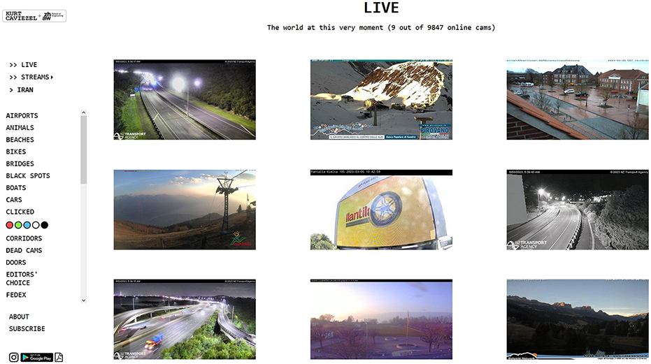
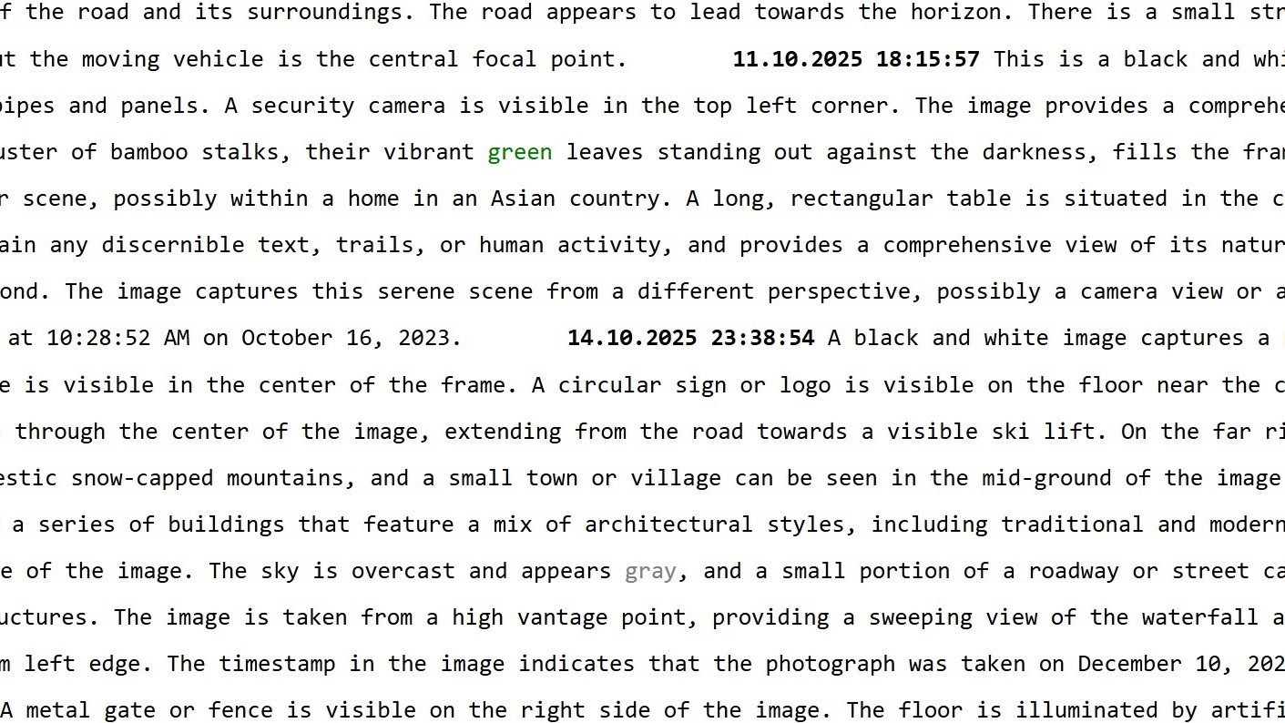
"WATCHING THE WORLD, The Encyclopedia Of the Now" is an art, a photography, an exhibition, an AI, a Big Data, an online project and uses only Open Data sources for this purpose. It photographs around the clock and around the globe the world in live mode by means of publicly accessible network cameras, presents the images simultaneously on the website in different modes and, with the help of AI, develops a new way of seeing, a new kind of photography.

LIVE

TEXT BASED SEARCH

EDITORS' CHOICE

NEWSTICKER

BIG DATA

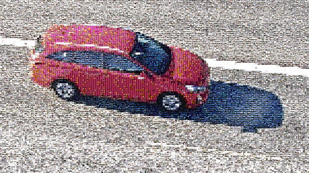
PHOTOMOSAIC

EXHIBITIONS | PRESS | ABOUT | | |

DISCLAIMER: This platform is intended for research and artistic use only.

Click or press any key to enter the page.